In the 1950s, outside the city walls, most of the land was still agricultural – occupied by villages and farmland. In 1953, Beijing’s government started to make expansion plans and allotted agricultural land for urban construction.
By 1958, according to the revised version of the then Beijing Urban Construction Overall Plan, a “dispersed group pattern” was chosen as the framework for urban-rural development. This meant that up until the 1990s, the rapid expansion of the urban area had left many former rural villages “marooned” inside the city and on its fringes, surrounded by modern construction.
Data on Beijing’s transient population indicates that from the early 1980s to 1994, the number of migrants increased from 264,900 to 3.3 million. Beijing authorities started to take action following official guidelines, such as “controlling the total number, optimizing the population structure, improving management and providing active services.”
The overall Beijing urban plan (1991-2010) stated that permanent residents in the city center area, considered as within the city’s Second Ring Road (built on the site of the former city walls), should be dispersed outside the downtown, with the aim of reducing the population of that area from 1.75 million in 1990 to 1.6 million by 2000, and further down to 1.5 million by 2010. In addition, according to the plan, renovation of old constructions in the old city center should speed up. However, in reality, from 1997 to 2005, the number of migrants into the urban area of Beijing increased by some 300,000 annually. The population of the urban area within the Second Ring Road reached 3.9 million by 2002.
In the early 2000s, after Beijing was awarded the right to hold the 2008 Olympic Games, rapid development made population and resource pressures much more prominent.
The Beijing Urban Plan (2004-2020) aimed to control the overall population of the whole city, including the hinterland, to within 18 million, containing the annual population increase to 1.4 percent. But the target again failed and government statistics showed that by 2010, there were 19.6 million permanent residents in Beijing.
The city started initiatives in 50 villages in the urban-rural fringe in 2010.
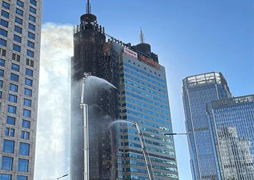
Tangjialing near Zhongguancun, known as China’s Silicon Valley, transformed from a village of 3,000 inhabitants to one of 40,000 after it became known as a center for cheap rental accommodation. Many of these renters were low-income graduates, who were nicknamed the “ant tribe” by the media due to their cramped living conditions. Illegal construction by villagers posed a serious potential danger.
A sweeping and complete eviction soon started from May 2010 until the end of the year.
In 2014, Beijing stepped up its vision of economic and social transformation. Optimizing and upgrading the industrial structure was as urgent as relieving the population pressure. The overall city development plan was revised to emphasize the coordinated development of a wider area, to include Beijing, Tianjin and Hebei Province in aspects of transportation, resources, energy, industry and ecological planning.
In 2015, the central government approved the outline plan for the coordinated development and integration of Beijing, Tianjin and Hebei, clearly pointing out that the core of the new national strategy is to devolve Beijing’s non-capital functions. Beijing’s eastern district of Tongzhou was formally named the capital’s administrative sub-center.
From 2013 to 2015, over 210 projects to renovate shanty towns were launched by authorities in the capital, including six villages near Tongzhou District center. By July 2015, evictions and demolition of regional wholesale markets started, and within five months, a number of major textile and clothing wholesale markets were closed down.
By 2015, data showed 233 markets were either demolished or upgraded in the city, which affected 33,000 vendors. Since 2016, 174 manufacturers were ordered to close, and another 25 wholesale markets were relocated, which affected more than 12,000 vendors.