Coordinated by the Ministry of Industry and Information Technology's Bureau of Information and Communication Administration, emergency teams from neighboring Guangdong Province as well as other provinces deployed satellite‑communication vehicles, satellite phones and multiple E40H communication‑enabled drones to rebuild critical information lifelines.
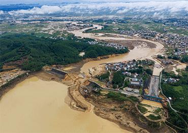
Nicknamed "airborne routers," unmanned E40H drones function independently of ground‑tower and cable infrastructure. They deliver temporary 4G coverage over a two‑kilometer radius, restoring village‑wide mobile service within one hour, much faster than ground repairs that could take multiple days. Operating amid mud‑choked roads and night time constraints, drone crews served isolated sites, where people had been cut off for 48 hours, allowing them to contact family. The drones streamed high‑definition imagery of floods, landslides and stranded populations, enabling precise supply allocation and shortening response timelines.
Five Guangdong E40H drone crews worked round the clock in shifts across eight disaster sites. Their combined flight time totaled 487 minutes, and airborne base‑station service ran for 1,205 minutes, supporting 16,597 user connections and 1,192 phone calls.
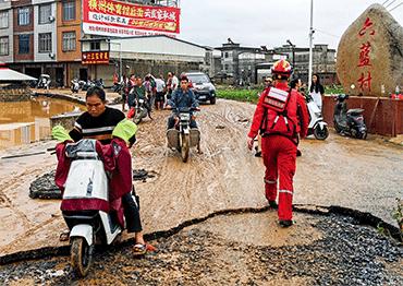
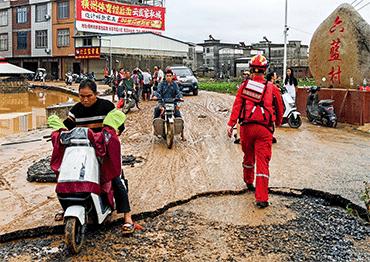
Guangdong sent two groups of personnel and equipment from five cities. A team from Zhongshan reached Guigang on July 8 and arrived in Shishe Village early the next day. "Silt blocked roads, stranding vehicles. Officials guided us on electric scooters. A routine 20‑minute drive turned into a two‑hour detour, and we only reached the village before dawn," Xu Chang of Zhongshan's Emergency Command Section told Red Star News in late July. More than 2,000 Shishe villagers had been isolated for over 48 hours. The team set up a ground satellite‑receiving station and as the drone circled overhead, villagers' phones began to work. Xu Chang noted that user‑connection and call volumes spiked sharply right after service restoration before gradually tapering off.
In other recent disasters, rescuers primarily used the Wing-Loong unmanned drone, developed by the Aviation Industry Corporation of China (AVIC) to enable communication.
Today, advances in China's commercial‑civil drone sector offer expanded options. Yue Tingting, vice president of Vertaxi, a low altitude economy firm, told Red Star News the company develops manned air‑taxis and unmanned aerial vehicles (UAVs) for public security, emergency response and infrastructure inspection. The Fukun E40H deployed in Guangxi was developed by Vertaxi subsidiary Zhongshan Fukun Aviation Technology. In 2024, Guangdong's emergency management authority purchased 15 E40H units.
The large Wing‑Loong has a 20.5‑meter wingspan, operates at 4,000 meters and covers a 72‑square‑kilometer signal footprint. The medium‑sized Fukun E40H has a 9.3‑meter wingspan, delivers signal coverage within a 50‑kilometer radius, and features superior maneuverability and cost‑efficiency.
According to Zhou Zhuo, an E40H operation and maintenance engineer, a Fukun E40H carries a maximum 50‑kilogram payload, flies over 800 kilometers and can operate in gale force 8 winds and light rain. Ground operators plot flight paths and transmit commands to form an ad‑hoc airborne‑ground broadband network that links to satellites.
Unlike ground base‑stations dependent on fiber‑optic cables and municipal power, and thus highly vulnerable to flood submersion and failure, the E40H's on‑board 4G base‑station payload links to satellites. Where ground network restoration once took days, the drone reconnects a village within an hour.
Aerial surveys, transmitting real‑time high‑definition imagery of landslide locations, flood depths, isolated settlements and population, enables targeted distribution of drinking water, medicine and boats, reduces relief‑resource waste and directs rescue teams to high‑impact zones. Zhou Zhuo told NewsChina that linked medium hybrid‑wing drones can compensate for large drone limitations.
 Old Version