Old Version
Special Report

Warm-up Questions

Arid Northwest China is getting wetter and warmer due to climate change, posing challenges in how to respond, including water management and disaster mitigation

By Huo Siyi Updated Jan.1

Tianshan Glacier in Yili, Xinjiang Uygur Autonomous Region, May 2022 (Photo by VCG)

Better known for its expansive deserts and harsh arid conditions, in the past five years Northwest China’s Xinjiang Uygur Autonomous Region has experienced more extreme summer weather, including rainstorms and floods. This summer saw heavy rain batter parts of the region, including Tianshan, Hetian and Bazhou, causing flash floods which wash away roads and bridges, and submerge farmland.  

Some climate experts said this trend of warmer and wetter summers may be beneficial for the arid region’s agriculture, but others point to the long-term unknown effects of volatile climate change for the region, suggesting there should not be a rush to expand farming in environmentally fragile regions, and that these changes will not fundamentally alter the region’s characteristic aridity, except in localized spots.  

Northwest China is particularly sensitive to the effects of global climate change. The inland provincial regions of Xinjiang, Qinghai, Ningxia Hui Autonomous Region, Gansu and Shaanxi are located on the northern fringes of the Qinghai-Tibet Plateau, where past recorded annual total precipitation averaged less than 200 millimeters. But since 1960, the average temperature has increased by 0.34 C per decade, about twice the global average, and precipitation is increasing at a rate of 9.32 millimeters per decade.  

Monitoring data shows that the water level in Qinghai Lake, China’s largest inland saltwater lake, has risen for 18 consecutive years since 2005. Urumqi No. 1 Glacier, the source of the Urumqi River in the Tianshan Mountains in Xinjiang, is melting much quicker, and the degradation of permafrost along the Qinghai-Tibet Highway is becoming increasingly obvious, according to the 2023 Blue Book on China Climate Change released by the China Meteorological Administration (CMA) in July.  

In 2002, Shi Yafeng, a scholar at the Chinese Academy of Sciences and China’s most eminent glaciologist, was the first to observe that Northwest China was getting warmer and wetter, including the Tianshan and Qilian ranges.  

Richer Biodiversity 
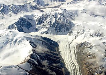
Yahr Memet, 34, a herder who tends his flock in the Tianshan Mountains, has first-hand experience of how the climate is changing as he observes the effect on his livestock, mostly Alpine fine-wool sheep and cashmere goats. Living in Tacun Village in the foothills of Mount Tomur, the highest peak in the Tianshan range at 7,443 meters, he told NewsChina that he feels the number of high-temperature days has increased every year. His flock, normally active, are listless when temperatures are high, seeking shade and not bothering to eat.  

But the increase in precipitation has improved some pastureland. “The grass grows well, and the sheep eat well,” said Tursun Tumur, manager of Xinjiang Tagerak Ecological Agriculture Company in Wensu County, Aksu Prefecture. Yahr Memet said the increase in summer rain has resulted in lush, better-quality grass. “Ten years ago, the grass was about 20 centimeters high. Now it’s 40 centimeters taller, and some grows past my knees,” Yahr said.  

According to data from Wensu County, in 2014, vegetation coverage was 35.4 percent, but by 2022, it had increased to 39.2 percent, and the pasture has become significantly greener.  

By midsummer, the pastures of Wensu are rich and verdant, with beads of moisture reflecting and refracting the sunlight. The dark green spruce forests are carpeted with Jerusalem sage, a perennial plant with broad leaves and small purple flowers. Mostly found in southeastern China and Southeast Asia, the plant used to be rare in this part of Xinjiang.  

In September 2022, scientists found a new type of moss – Grimmia caoton-giana – in Mount Tomur National Park. It belongs to the group of plants known as bryophytes, which includes liverworts, hornworts and mosses. They are highly sensitive to changes in humidity, which can spur growth.  

Tursun believes that biodiversity enrichment is a significant outcome of the changing climate, though he pointed out that other factors, such as a ban on grazing, had also had an effect.  
Xinjiang Meteorological Bureau data shows an average temperature increase in Xinjiang of 1 C from 2001 to 2022 compared to the 1961-2000 average, and average precipitation increased by 25 millimeters, a rise of 16.1 percent. In the last decade, precipitation in southern Xinjiang increased by nearly 15 percent.  

According to data from the CMA, the annual average temperature in Xinjiang from 1971 to 2000 was 7.8 C, and the annual average temperature warming rate from 1961 to 2010 was 0.32 C per 10 years, higher than the national and global change levels in the same period. The temperature rise in the eastern part of northern Xinjiang and the eastern Tianshan Mountains is more distinctive at 0.6-0.8 C per 10 years.  

Ding Yihui, an academic who consults on the National Expert Committee on Climate Change, told NewsChina that warm Atlantic ocean currents have strengthened since the 1980s, and through the interaction of sea and air, the westerly air circulation is bringing in warmer and more humid air to northwest China. As the Arctic warms, cold air moves increasingly south, thus bringing a variety of vapor sources generated in the Arctic and the Pacific Ocean. Along with these sources of precipitation, scientists found that glacial meltwater and river runoff are major sources of water in northwest China. The trend in Xinjiang is a regional result of global climate change.  

Yu Rucong, former deputy director of the CMA, told NewsChina that the Qilian Mountains, located between Qinghai and Gansu provinces, have a direct effect on precipitation processes, and as global warming intensifies the impact of the westerly prevailing wind belt from west to east, it increases convective precipitation as warm moist air rapidly rises, condenses, and falls, possibly as extreme rain or hailstorms.  

Regional Imbalances 
Zhang Zhijun, a senior engineer at Aksu Regional Forestry Development and Support Center, told NewsChina that vegetation coverage has increased most in the Tianshan Mountains where they meet the plains.  

However, drought has increased in other areas. In southwest Xinhe County and parts of Keping County in Aksu, large areas of temperate desert grassland are degraded. “Although it is affected by the warmer and wetter climate, the vegetation improvement is not obvious in such regions,” Zhang said.  

According to monitoring data from Aksu Regional Forestry and Grassland Bureau, temperate desert grassland accounts for up to 60 percent of the 3.4 million hectares of grassland in Aksu. The vegetation is mainly xeric plants – those which tolerate extreme aridity – and the annual growth of vegetation is greatly affected by rainfall. Xie Yuanyuan from Aksu District Grassland Workstation said these desert plants cannot adapt to the new humid conditions.  

Jing Maowen, a researcher at Gansu Province Qilian Mountain Water Conservation Forest Research Institute, who has been monitoring the region for 50 years, noticed that as precipitation increases and therefore vegetation, the amount of water required for plant growth will increase, eventually striking a new balance. Once this equilibrium is set, it will have a positive substitution effect on the vegetation growth and biodiversity of the whole region.  

Chen Yaning, director of the State Key Laboratory of Desert and Oasis Ecology at the Xinjiang Institute of Ecology and Geography, told NewsChina that the warmer, wetter climate will not fundamentally change the basic pattern of the desert landscape in Northwest China, although there is much uncertainty in how it could change. This is why there needs to be a proactive stance toward ensuring there are more protective safeguards for the region’s ecological systems, he said.  

Yao Junqiang, deputy director of the Urumqi Desert Meteorological Research Institute, said that although their research from 1961 through 2015 shows proof of the “warmer and wetter trend,” after 1997, they also observed increased drought in terms of frequency and length. Some areas of Xinjiang have in fact experienced a “reverse trend,” with increasing aridity.  

Police help a herder to relocate his sheep from a fooded area, Kashi, Xinjiang Uygur Autonomous Region, July 3, 2021

Police offcers check the food situation, Altay Prefecture, Xinjiang, July 2, 2021 (Photos by VCG)

A food control project under construction in Aksu Prefecture, Xinjiang, March 4, 2023 (Photo by VCG)

Extreme Weather 
Drought intensified in Xinjiang after 1997 due to increased water evaporation related to changing wind speeds, found a study by the Xinjiang Institute of Biological Studies of the Chinese Academy of Sciences. Yao Junqiang noticed that no matter how much the precipitation increased in Northwest China, it mostly evaporated. “It’s like a funnel. The more arid the area, the greater the potential evaporation, and the amount of potential evaporation in southern Xinjiang is the most significant. Therefore, the drought in southern Xinjiang is more serious than in northern Xinjiang,” Yao said.  

In Yao’s opinion, both the increased incidence of regional drought and the higher frequency of extreme weather have caused vegetation degradation. The pattern of precipitation has become irregular, with the interval between rainfalls increasing, meaning more days of continuous drought. At the same time, the frequency and intensity of extreme rainstorms are increasing, with extreme rainfall accounting for about 50 percent of total precipitation.  

In Wensu, Tursum has observed these changes. “When I was a child, you’d get rain for one or two hours a couple of times a day on the grassland, but it wasn’t heavy. Now it only rains once every three days or even once a week. Even in summer, it doesn’t rain much, but when it does, it pours. We’ve had more floods and hailstorms. Some of the pasture was flooded, and it will take at least 10 years to recover.”  

Yao Junqiang said two types of areas in Xinjiang are experiencing the most serious vegetation degradation. One type is areas that are dominated by natural vegetation, which is obviously affected by seasonal precipitation fluctuations, such as the Yili River Valley, Tacheng and Altay in northwestern Xinjiang. The other type is transitional zones between deserts and oases.  

“Transitional zones have not only shrunk, but many have completely disappeared, in particular at the southern edges of the Taklimakan Desert,” said Lei Jiaqiang, vice president of the Chinese Society for Sand Control and researcher at the Xinjiang Institute of Ecology and Geography.  

Lei added that both oases and deserts are expanding, but transitional zones have continuously contracted. As a buffer between desert and oasis, the transitional zone has two basic functions: blocking and fixing sand, and maintaining the integrity of the regional ecosystem. In the long term, the disappearance of transitional zones is a significant threat to biodiversity, as well as becoming a new source of sand. He found that in the last two years, the frequency of dust and sandstorms in the Taklimakan Desert and seasonal uncertainty have increased due to escalating extreme weather processes.  

Glacier Retreat
Particular attention is being paid to ice coverage in the region, especially in the Tianshan and Qilian ranges. Scientists have been monitoring the region’s glaciers, in particular their retreat, as glacial meltwater is an important source of river runoff. The northwest arid region is dominated by inland rivers, almost all originating in mountainous areas, Chen said. Water resources are mainly composed of glacier and snow meltwater in the high mountain zone, precipitation in the sub-alpine forest zone and groundwater in the low mountain zone. Glacial meltwater accounts for about 30 percent of the surface runoff in northwest arid areas.  

“The expansion of vegetation in the northwest is considered an important sign of the warmer and wetter trend, but it’s mainly caused by the large increase in water supply from mountainous areas,” Chen said. This is because global warming accelerates water circulation, leading to increased precipitation in mountainous areas, and an accelerated melting of glaciers and snow, which increases river runoff.  

According to Shi Yafeng’s research, Bosten Lake, the largest lake in Xinjiang and one of the largest inland freshwater lakes in China at about 1,000 square kilometers in surface area, has experienced acute changes. He found the water level had been falling since the 1950s, shrinking by 13 percent, but suddenly began to rise in 1987, reaching 4.5 meters as of 2002.  

Chen Yaning also noticed that since the mid-1990s, mountain water supply in the arid northwest region increased by about 11 billion cubic meters. The increase in glacier meltwater and precipitation in mountainous areas has had a positive effect on the availability of irrigation water. 

“Xinjiang’s agriculture depends on irrigation. The significant increase in water supply from the mountains over the past 20 years is critical for agricultural production,” Chen said. But this is only a short-term effect. Experts said that as global temperatures continue rising, small glaciers will disappear first, posing a threat to water resources.  

“Glacier retreat will directly affect future water security in northwest China, and this needs more attention,” Chen said.  

Urumqi No. 1 Glacier, only 130 kilometers away from Xinjiang capital Urumqi, is one of 50 global “reference glaciers” that scientists continuously monitor, the only one monitored in China. The closest glacier to a major urban area in the world, it has been shrinking since the 1950s. In the last two decades, it has retreated 100 meters.  

Chen said that over the past 60 years, the glaciated area in western China has decreased by 18 percent, and that in Xinjiang has shrunk by 11.7 percent. Glaciers in the Altai Mountains have retreated most significantly, down by 37.2 percent, because the area contains mostly small glaciers of less than 1 square kilometer, which are more sensitive to climate change.  

According to a simulation by Chen’s team, by 2045, the runoff of some rivers in the Tianshan and Kunlun mountains in the northwest arid region will remain high, the volatility will continue to enhance, and the contribution of glacier meltwater to runoff in most basins will peak in 2045-2070. For some small glacier-fed rivers, the turning point may arrive even earlier, by mid-century.  

Lakes in the Taklimakan Desert, Xinjiang (Photo by VCG)

Potential Measures
To adapt to the changing climate conditions, Chen Yaning suggested more construction of water control and network projects in the mountains, particularly as Xinjiang lacks water conservancy projects and the efficiency of existing projects is very low. Although there are 671 reservoirs, cumulative storage capacity only adds up to 20.6 percent of their full capacity. Water-use efficiency in industry and agriculture must be improved, and he suggested deploying cloud seeding technology in mountain areas.  

In Lei Jiaqiang’s view, the key is to make thorough plans in both the development of agriculture and ecological restoration through analyzing the amount of water resources and future reserves. Assumptions that increased water supply will be long-lasting may be false, and localities need to take account of this when planning future agriculture and industry.  

“In some places where pastures are growing better, locals want to push livestock farming, but they should be cautious. If they want to benefit from these climate changes, they should consider where this water is coming from. Does it come from more precipitation, or from glacier meltwater?” meteorologist Yu Rucong said.  

“We have to look at specific conditions to formulate short- and long-term measures, especially on how to deal with the reduction of water resources in the future. We should not focus purely on present benefits while causing excessive depletion of water resources,” Yu said. 

Print